


Ste Candie

Pascal-83
User
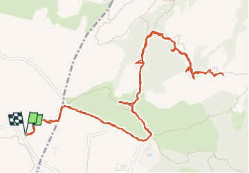

Length
4.3 km

Max alt
332 m

Uphill gradient
189 m
Km-Effort
6.9 km

Min alt
172 m

Downhill gradient
189 m
Boucle
Yes
Creation date :
2025-05-10 06:22:30.855
Updated on :
2025-05-10 09:56:46.598
3h33
Difficulty : Medium

FREE GPS app for hiking
 SityTrail
IGN / Geographical institutes
SityTrail Plus
The world is yours!
About
Trail Walking of 4.3 km to be discovered at Provence-Alpes-Côte d'Azur, Var, Le Muy. This trail is proposed by Pascal-83.
Description
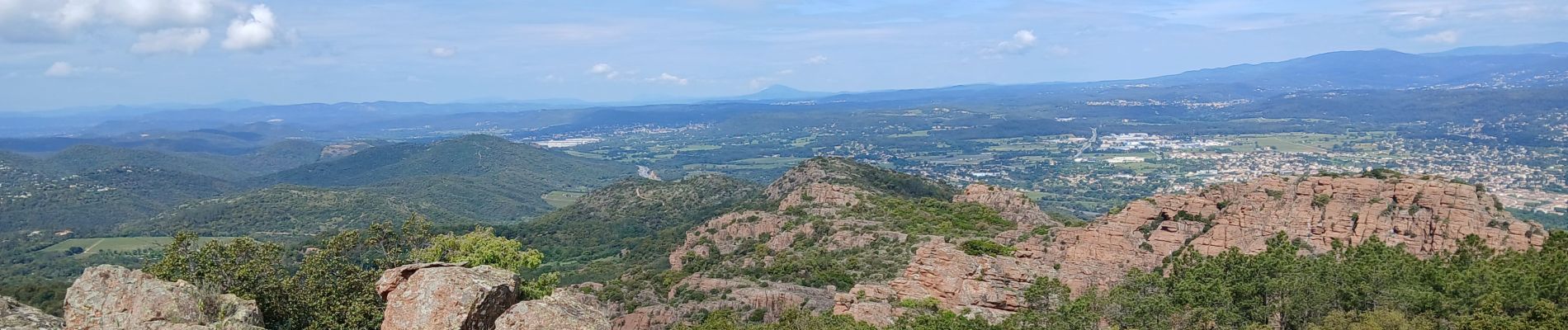
Sortie Comité des Sites de Roquebrune
Photos


Positioning
Country:
France
Region :
Provence-Alpes-Côte d'Azur
Department/Province :
Var
Municipality :
Le Muy
Location:
Unknown
Start:(Dec)
Start:(UTM)
304710 ; 4813412 (32T) N.
Comments